On our way to Death Valley, Garmin routed us through the
Panamint Valley, easy so far. Then there
was a sign…”pavement ends 1000 feet” and we found ourselves on a gravel road of
questionable utility. In fairness to the
highway crew, they were working on it and we got over the 2.5 miles to Hwy 190
but it was a bit bizarre. Mike said that
any road that regularly floods does not get paved. After the rains, the road crews grade and
re-gravel it.
We had just turned onto CA 190 headed for the last lap into
DV. There was a roar, the rig shook, and
we thought we were caught in a tractor beam and being abducted by aliens. When I looked out the front, there was a
military jet, very low and right over us.
He punched it, went vertical, and was gone
.
Not much in the way of communication technology works
here. My phone won’t work, there’s no
WiFi, etc. Pleasant, in a way.
Death Valley is other-worldly. When you look around, you don’t see much
that’s familiar. Parts of it look like
the way I envision Mars. (Maybe we have
been abducted.) I took dozens of photos
that don’t even come close to doing justice to the staggering beauty and the desolation.
At Stovepipe Wells, where we are staying, there is a
monument. Some ’49-ers thought they
could take a shortcut across Death Valley to arrive at the gold fields. It ended in near disaster. The wording on the monument:
Near this monument Jayhawker group
of Death Valley 49’ers from the Middle West who entered Death Valley in 1849
seeking a short cut to the mines of central California, burned their wagons,
dried the meat of some oxen, and with surviving animals, struggled west on
foot.
Had to have been a bunch of Kansans, as I don’t know any
other group called Jayhawkers. When you
see the immensity of this valley, (deceptive because distances are much
farther than you think), you wonder how crazed these guys were to attempt this.
Just down the road from the park are sand dunes, another
eerie sight. Although these are not the
tallest (those are in the far north area and of the park accessible only by specially
equipped vehicles), it’s fascinating to watch how they shift and move. And there are dust devils, miniature
tornadoes. I stood and watched one for
perhaps over a minute. Usually they form
and dissipate in moments.
We saw Furnace Creek a few days ago. It is startling to see this intensely green
patch in the middle of miles and miles of desert. There is a spring-fed creek which supplies
the water here. My granddad’s brother was
a physician and worked for a mining company in Furnace Creek for years. I stopped at the Borax Museum and asked the
lady behind the counter if there were any personnel records for the Furnace
Creek mines. Unfortunately, none
survived. I checked the old photos on
the walls, hoping to find him. No
luck.
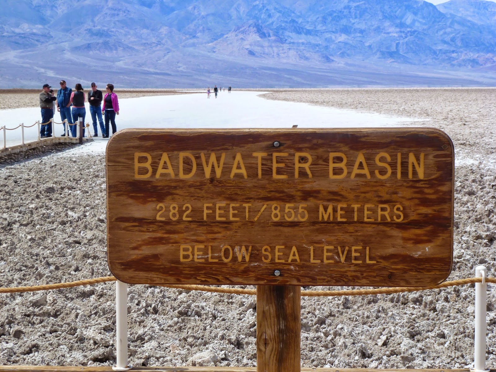
From Furnace Creek we continued south to Badwater Basin, 282
feet below sea level. There was a heavy
storm a few weeks ago, so the basin still has a little water. In a few weeks, without more rain, this will
disappear, too. The wind must have been
blowing 50 miles per hour. The white you
see in the photo is salt flats.


No comments:
Post a Comment