Thursday, April 24, 2014

Western Sierras and the Search for David Shrum


I have always wanted to see Lake Tahoe.  Mark Twain (who lived at Virginia City early in his career), said it is the most beautiful lake in the world.  Who am I to argue.  See photos.


We arrived Tuesday at the park at the Nevada County Fairgrounds in Grass Valley, CA.  Our original plan to go north on 395 to Reno, then take I-80 down to the road to Grass Valley fell apart.  On the last night we were in Coleville, we had high winds (high enough to rock the rig).  We delayed leaving in hopes the wind would drop but no luck.  The Nevada DOT closed 395 north of Carson City so we took 50 back up to South Lake Tahoe and then down.  Got to Placerville and Garmin sent us north on a road fine for passenger traffic but not so fine for towing a 35 foot RV.  I hope Mike will be speaking to me again soon.


My oldest brother, Larry, had connected with our mother’s distant family in Virginia in 1990 and bought a privately published book about Mom’s family.  In that book, there is David Shrum, a somewhat mysterious figure.  The oldest son in the family, he went to the California gold fields in the 1850’s.  The book’s author, Virginia Shrum, could document that he was in Omega, California, a mining town, from a letter he wrote to one of his brothers in 1858.  And then no more is heard of David.  Virginia thought he had been killed in a mining accident but had no proof.

Larry’s lovely daughter Dana lives in Grass Valley next to Nevada City, California, the county seat of Nevada County.  Nevada City is about 20 miles from the site of Omega of which no trace exists today.  She spent the day with us yesterday searching for David.  There are two small historical societies in town, one across the street from the front of the county courthouse and the other across the street from the side of the courthouse.  We started with the one at the side.  They had information about Omega but no trace of David.

We decided to take a road trip to see if we could find the site of the town.  Dana had talked with Forest Service employees and they said the town itself has been wiped away and nothing exists there anymore.  Nonetheless, we sallied forth.  We stopped at a scenic overlook.  Omega was to the right and down the mountain from where Dana is standing.  Before we tackled the Omega gravel road, we went down to another mining town which still has a few residents.


We stepped into the Hotel Washington and back to the 1870’s.  This is spectacularly beautiful country. Photos 2 and 3 below were taken from the balcony of the hotel.  As we left, we had a brief conversation with an elderly man who was standing in front of the hotel, smoking.  He said at one time the hotel had been condemned and was scheduled for demolition.  His partner bought it and together they restored it. 


On to the elusive Omega.  We found the road and turned down the mountain.  Omega supposedly had been two or three miles from the junction.  After we had driven five miles, the road had gotten progressively narrower and rougher so we decided to turn around.  Omega was probably obliterated by snow slides.  (It also burned to the ground a couple of times and was re-built.)

We returned to the second historical society not expecting anything.  Amazingly, they had a copy of his will and they could identify the date of death and that there had been an obituary in the local newspaper.  I got a copy of his will and the newspaper information but the microfilm of the papers was back at the first building. 

We returned to the first society and the volunteers were happy to load the microfilm for the Nevada City newspaper for the correct year.  So then it was just scrolling forward and backward until we found the obituary.  From that, we found the report a week earlier of the accident.  Amazing.  (Note to Omar:  he was accompanied to the grave site by his friends in the Sons of Temperance society.)

The accident had occurred on April 16 and he must have been loaded on a wagon and taken into Nevada City.  Can't imagine how bad that must have been.  On April 17, he found a lawyer, wrote his will, and died April 22.  Still don't know in which cemetery he is buried, as the obit does not say.  Dana said she will continue to hunt for his grave.

One of the ladies in the historical society told me an interesting story today.  A local cabinetmaker also made coffins.  Business must have been brisk and he decided he should buy a piece of land for a cemetery and make money on that end, which he did.  Pine Grove Cemetery, Nevada City, California.


Saturday, April 19, 2014

Eastern Sierras

We turned north on Hwy 395 and headed for Coleville.  Spring is starting here and the green was a welcome sight after months in one desert or another.  The park we are in sits at the base of a 700 foot cliff.  (Can you find the flag in this picture?)  The owner says they hike up July 5th every year and replace the flag, as it is in shreds by December.


I was coming back to the rig from walking the dogs Friday evening (4/11) and saw law enforcement vehicle lights at what appeared to be the entrance to the park.  So, being the nosy person I am, I walked on to where I could see two Mono County sheriff's deputies yelling at a combative man, "Relax!  Relax!"  They handcuffed him and tucked him into their vehicle, frisked another guy, and then turned the drug dog loose on the car.  He was so excited he jumped into the trunk, into the passenger compartment, ran around the car dancing.  And he got his reward, his favorite toy.  It was almost dark and I was getting cold so we went inside.  Some local drug mule is in jail today.  One would think he would have a nicer car than a low-end Toyota.

Mike spent all day Monday smoking a tri-tip, a better cut than brisket but similar.  It was amazing.  He hasn't had the smoker out since we left NM so we were ready for 'cue.

We drove up to Virginia City NV today.  It's only 60 miles or so.  As usual, I am astounded by the number of casinos, starting right at the state line.  We were stopped on the north side of Carson City for a red light.  On one corner was the Jackpot Casino and the SlotWorld.  On the other was SuperPawn.

 I continue to ponder why Nevada seems has so many self-storage units.  What are these people stashing?  There are dozens of units, maybe hundreds, visible from Hwy 395 in Carson City.  This burg is only 50,000 people.

And speaking of population, in 1860, Virginia City had 30,000 people.  As we were walking around today, I lost count of the number of casinos and bars and counted only three churches.  Well, the town burned in 1870-something.  Maybe the churches burned and the saloons survived.

I was surprised to find Virginia City is still an active town.  The Comstock Mining Company has a big open pit mine so there are people living here who work at the mines.  There's a very nice school with solar panels.


Most of the old buildings are on what must have been the main drag, C Street.  See photos below.  And people who live here must have a sense of humor.


There was a woman handling out two-for-one coupons for drinks of any kind (beer, wine, coffee, etc.) and she encouraged us to take the dogs into the casino.  The bar is behind Mike, and at the bar was a very large lady seated on a stool with a small dog at her feet.  We went to the back and sat at a table.  Mike got up with the dogs to find the lady with the dog biscuits.  Suddenly, the little dog at the bar took off after them and pulled the lady off her bar stool all the way to the floor.  She landed on her butt with a large thud.  Who would have thought the little dog was so strong?

Walking the wooden sidewalks of Virginia City feels authentic.  They slope down to the street from the edge of the buildings and they "ripple" with the contour of the ground.  Disorienting dead sober and REALLY difficult of you had a few (at 6100 feet alcohol hits you a lot faster).


Barbecue

We have found that the number of barbecue joints diminishes as you move west and the ones you can find are generally not all that good (as compared to the dozens in KC).  The park owner recommended a place in the tiny town south of here so we tried it Friday afternoon.  We were the only customers but it was 3:30, between the lunch crowd and the dinner crowd.  The owner spent the whole time we were there talking barbecue with us.  He's a transplanted Houston, Texas guy who smoked as a hobby.  Twenty years ago his mother-in-law died and his wife wanted to be closer to her father who owned a little tourist cabin operation in Walker.  So he opened a little barbecue and he's still at it.  Good 'cue.  Mountainview Barbeque, Walker CA.

Virginia City is shabby and dilapidated compared with Deadwood and Tombstone.  The bbq guy said that lots of the VC locals resent the tourism business (although glad for the money) and owners of the buildings may or may not put much effort into them.  

We are starting to pack up to move to Grass Valley on the western slope of the Sierras.  To summarize the eastern side:  all the lakes we have seen are 15-20 feet below their normal height.  If anyone has doubts to how severe the drought is here in CA, just look at the lakes.  Forecast for this area next week is rain for a week.  Here's hoping they get it.  

This sign was in Walker, just down from Mountainview Barbeque.


Sunday, April 13, 2014

The Last of Death Valley


Our long-time friends from Idaho, Kathy and Bosco Bosler, joined us at Stovepipe Wells for the last few days in the park and we re-visited Titus Canyon and Rhyolite.  Bosco had a geology minor in college and provided running commentary on what we were seeing.  (Thanks, Bosco!)


The Bottle House at Rhyolite:  Built of old beer and liquor bottles as a raffle prize.


Bosco and Kathy wanted to see Scotty's Castle so we did a couple of other sites.  See photos below.

Mike decided not to play this course.


Zabriskie Point is a a much-lower viewing platform than Dante's View but it's in the same area of the park.  There are miles of hiking trails which cross the area around the viewing platform.  The retaining walls which support the platform are beginning to crumble due to old age and this area will soon be closed to the public while it's being rebuilt.


Never underestimate the public's capacity for doing dumb things.


Another view from Zabriskie's Point.

Also in the same general area of the park is a scenic drive called Artist's Drive, with a spur to another area called Artist's Palette.  This photo doesn't begin to do justice to the beauty of this area.  There are huge splotches of every color except blue, we decided.  Every possible shade of red, rose, rust, mint green, dark green, white, pale tan to brown/black, dark purple,dark gray, lavender, and any other color you can imagine.

We re-joined Kathy and Bosco for one last excursion to the charcoal kilns, located in Emigrant Canyon off Death Valley.  With all the mining operations in the valley, there was an enormous need for a source of heat for smelting the ore.  Obviously, there are no trees or coal in the valley itself.  At a much higher elevation in a side canyon are pinyon pines.  Imported Chinese workers built the kilns designed by a Swiss engineer and then worked the kilns and drove the finished charcoal to the smelters.  I can't think of a much worse job.  You can still smell the smoke when you walk into a kiln.


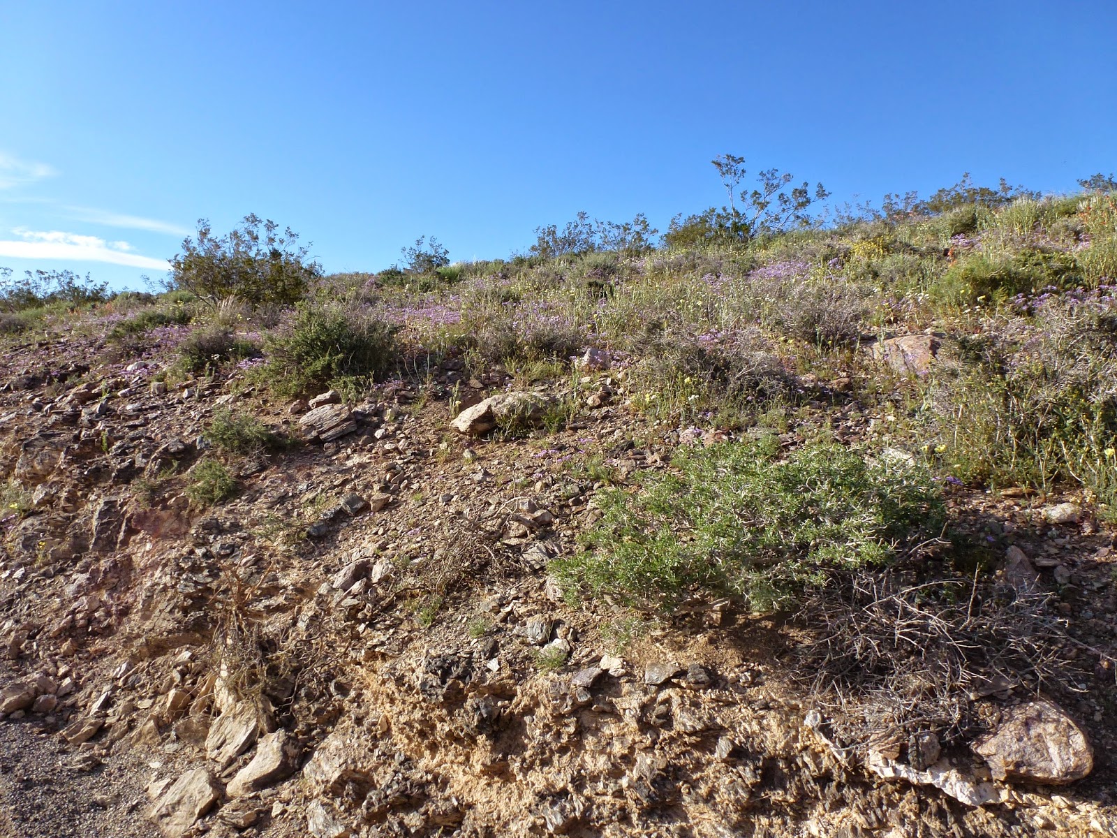
Our timing for Death Valley couldn't have been much better.  There had been rain several weeks earlier. Desert plants bloom when there is water, not necessarily in any season.  At the higher elevations, the wild flowers were strewn across the hillsides.  These photos aren't even close to showing how beautiful it was.

And the last full day we were there, temps hit 100 degrees.  It will only go up from there.  Late fall/winter/spring is definitely when you want to see this place.  


We left Stovepipe Wells Thursday morning, 4/10.  Getting out of Death Valley going west was a long but manageable pull up and then the downhill run to the Panamint Valley floor.  However...the pull up Hwy 190 out of Panamint Valley was very long, very steep, and very scary.  One of Bosco's friends had told him not to go in this way and he is right.  The downhill run on Hwy 190 would be extremely scary in a passenger car, let alone hauling a 7 ton RV.

To summarize:  Death Valley must be one of the most weirdly beautiful places on earth.  If it's not on your bucket list, it should be.  And plan to stay a few days as you can't possibly see even a fraction of its wonders in a drive-through.  And try to have a 4x4 with high clearance so you can get into places like Titus Canyon.  If you don't own one, you can rent one in Furnace Creek.


Friday, April 11, 2014

Death Valley Part 2

Have I mentioned the issue of the price of fuel here in Death Valley?  We thought this was shocking at Stovepipe Wells until we went to Furnace Creek. 


(This actually wasn't the worst.  As we left Death Valley on Highway 190 west, we saw a station in Panamint Springs where every type of gas was over $6, some of it $6.50-ish.)

We made trek to Beatty NV as a neighbor in the park told Mike diesel was much cheaper.  And it was $3.79.  We laughed as we drove out of town, as we had seen four or five casinos in a half mile in this little run-down crossroads. 

There was a sign pointing to Rhyolite, a ghost town, so we headed that direction.  A few crumbling buildings left and one large and once-fancy structure.  And it had been….a casino.  The brochure said it was also the train station but the sign didn't mention that.  http://en.wikipedia.org/wiki/Rhyolite,_Nevada


There is a sculptor who lives in a hovel in this town and has a sculpture garden of sorts.  The title of the piece below is "Prospector with Hopeful Companion".  Why a penguin?


The sign below was posted at Rhyolite for those who wanted to wander around and perhaps take a few souvenirs.


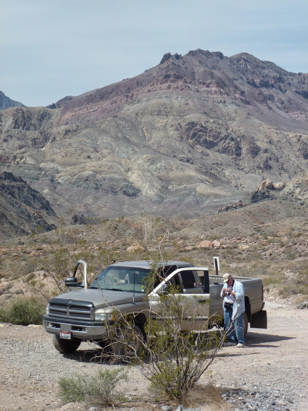
As we left Rhyolite, I checked the NPS map.  It showed the entrance to Titus Canyon and the road went all the way through to the main north-south road on the valley floor.  The sign at the entrance said “4-wheel drive, high clearance vehicles only”.  Okay, we have a Ram 3500 dually with 4 wheel drive, we should be good.  The first 10 miles or so were just a really bumpy gravel road.  And then the road started to climb…and climb…and climb, twisting and turning its way through Red Pass.  This is not a trip for the faint of heart.  The road gets very narrow and you have the mountain on one side and a sheer drop to the canyon floor on the other and no railing.   The two dogs were bouncing around like marbles in a tin can.  

There is a ghost town in the canyon and a lot of abandoned mines.  (The Park Service has warnings on everything to stay away from the mines.)  Slick marketers were at work...


"This was a mining boom town founded on wild and distorted advertising.  300 hopeful people swarmed here and a post office was established in August 1926.  In February 1927 the post office closed and the town died."

On our way out of the canyon... will the truck fit?


We went to Dante's View, approximately 5200 feet above the valley floor at the Furnace Creek Inn.  From here, you can see most of the valley. The last quarter mile up to the View is a 15% grade.

I guess I never thought about it but Death Valley was once a giant lake. You can see the alluvial fans everywhere which were the pathways for water out of the mountains into the valley.  At the end of the last ice age, Death Valley's climate was much wetter and the surrounding mountains had glaciers.


Death ValleyPart 1 - Stovepipe Wells

On our way to Death Valley, Garmin routed us through the Panamint Valley, easy so far.  Then there was a sign…”pavement ends 1000 feet” and we found ourselves on a gravel road of questionable utility.  In fairness to the highway crew, they were working on it and we got over the 2.5 miles to Hwy 190 but it was a bit bizarre.  Mike said that any road that regularly floods does not get paved.  After the rains, the road crews grade and re-gravel it. 

We had just turned onto CA 190 headed for the last lap into DV.  There was a roar, the rig shook, and we thought we were caught in a tractor beam and being abducted by aliens.  When I looked out the front, there was a military jet, very low and right over us.  He punched it, went vertical, and was gone
.
Not much in the way of communication technology works here.  My phone won’t work, there’s no WiFi, etc.  Pleasant, in a way.

Death Valley is other-worldly.  When you look around, you don’t see much that’s familiar.  Parts of it look like the way I envision Mars.  (Maybe we have been abducted.)  I took dozens of photos that don’t even come close to doing justice to the staggering beauty and the desolation. 

At Stovepipe Wells, where we are staying, there is a monument.  Some ’49-ers thought they could take a shortcut across Death Valley to arrive at the gold fields.  It ended in near disaster.  The wording on the monument:

Near this monument Jayhawker group of Death Valley 49’ers from the Middle West who entered Death Valley in 1849 seeking a short cut to the mines of central California, burned their wagons, dried the meat of some oxen, and with surviving animals, struggled west on foot.

Had to have been a bunch of Kansans, as I don’t know any other group called Jayhawkers.  When you see the immensity of this valley, (deceptive because distances are much farther than you think), you wonder how crazed these guys were to attempt this.

Just down the road from the park are sand dunes, another eerie sight.  Although these are not the tallest (those are in the far north area and of the park accessible only by specially equipped vehicles), it’s fascinating to watch how they shift and move.  And there are dust devils, miniature tornadoes.  I stood and watched one for perhaps over a minute.  Usually they form and dissipate in moments. 


We saw Furnace Creek a few days ago.  It is startling to see this intensely green patch in the middle of miles and miles of desert.  There is a spring-fed creek which supplies the water here.  My granddad’s brother was a physician and worked for a mining company in Furnace Creek for years.  I stopped at the Borax Museum and asked the lady behind the counter if there were any personnel records for the Furnace Creek mines.  Unfortunately, none survived.  I checked the old photos on the walls, hoping to find him.  No luck. 

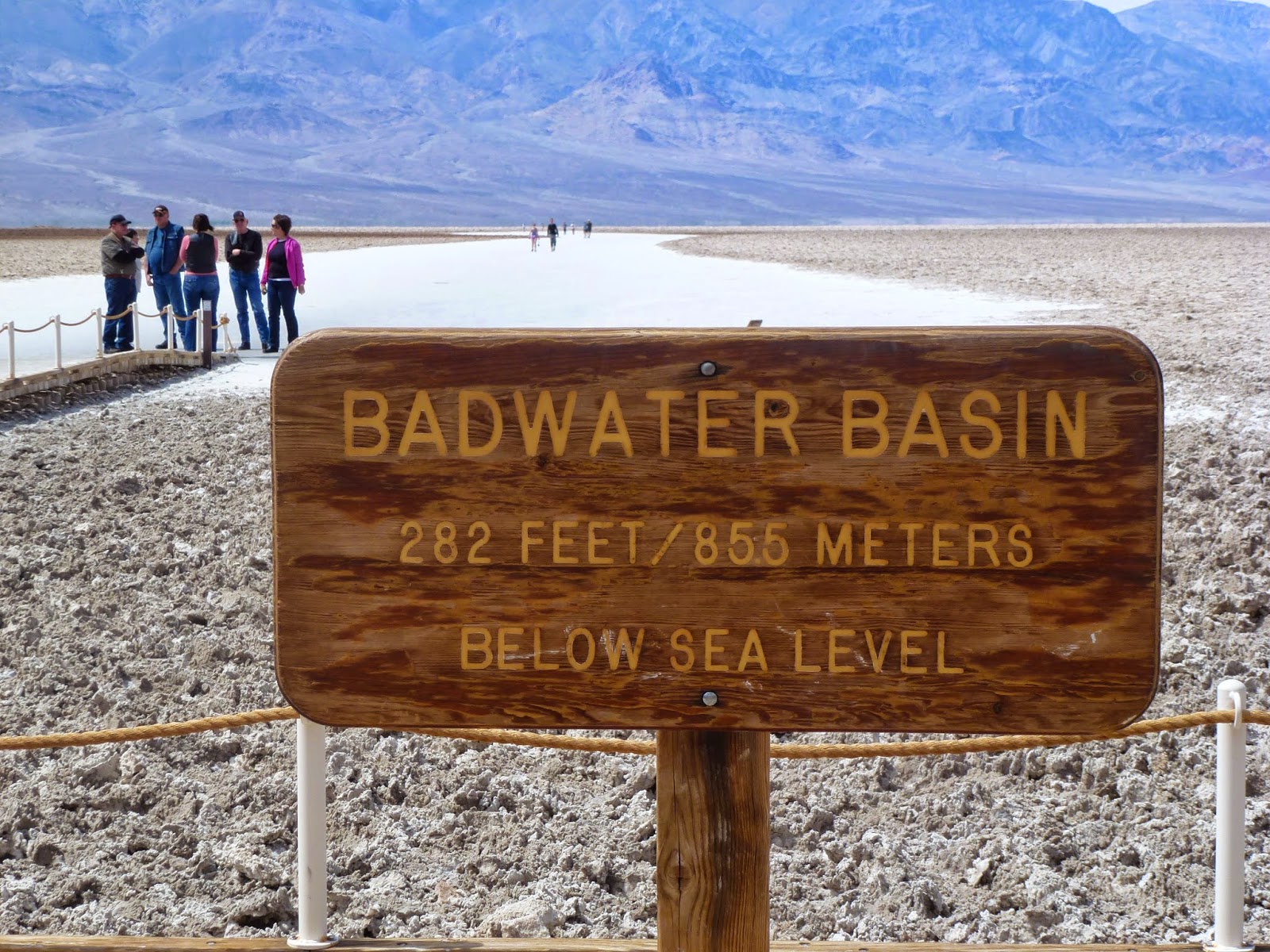
From Furnace Creek we continued south to Badwater Basin, 282 feet below sea level.  There was a heavy storm a few weeks ago, so the basin still has a little water.  In a few weeks, without more rain, this will disappear, too.  The wind must have been blowing 50 miles per hour.  The white you see in the photo is salt flats.